Enhancing Biomass Mapping with Super-Resolution powered by Sentinel-1/2
We are pleased to highlight a new scientific contribution partially supported by Embed2Scale: “GSR4B: Biomass Map Super-Resolution with Sentinel-1/2 Guidance”, which was presented at ISPRS Geospatial Week 2025 in Dubai, on April 8, 2025.
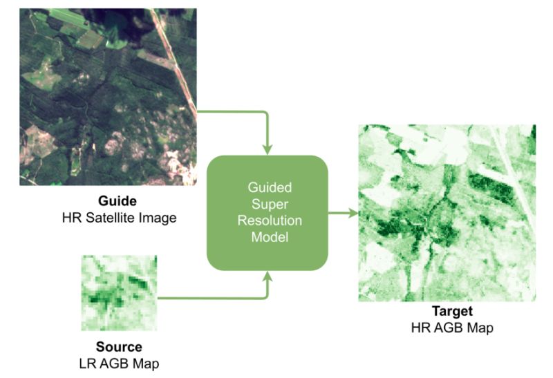
This research, led by the University of Zurich team, demonstrates how existing low-resolution aboveground biomass maps can be super-resolved to 10m using Sentinel-1 and Sentinel-2 satellite imagery. The method outperforms direct regression approaches, offering higher accuracy and reduced bias, particularly across biomass extremes—an important advancement for forest monitoring, carbon estimation, and environmental modelling.
Read the paper here
Visit the GSR4B page
Congratulations to the University of Zurich authors: Kaan Karaman, Yuchang Jiang, Damien Robert, Vivien Sainte Fare Garnot, Maria João Santos and Jan Dirk Wegner!